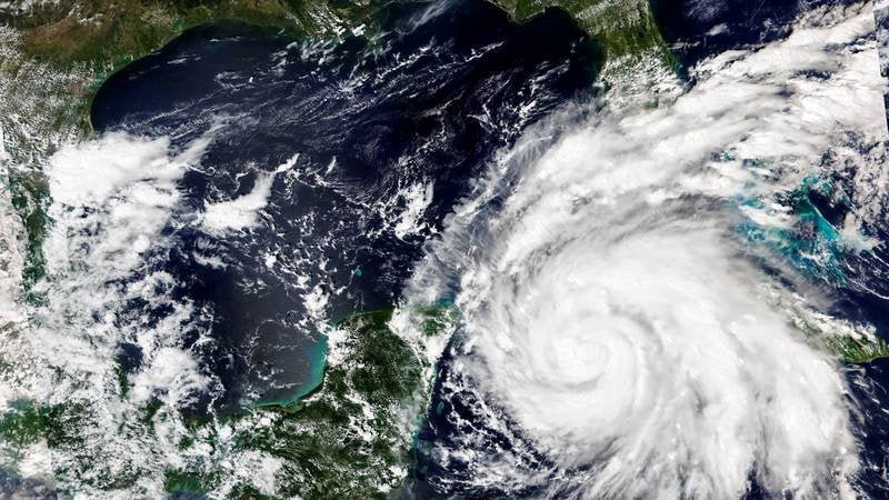
Southwest Florida Braces for Hurricane Ian to Make Landfall – Fort Myers and Punta Gorda residents and businesses are prepared for the arrival of Hurricane Ian. Hurricane Ian grew to a Category 4 storm as it approached Florida on Wednesday, with the storm’s center expected to make landfall on the west coast of the state as early as this afternoon.
As of 7 a.m. ET, maximum sustained winds were close to 155 mph, with higher gusts . This is just two mph away from getting elevated to a Category 5 speed. The National Hurricane Center has issued evacuation orders for millions of people due to “life-threatening storm surge, catastrophic winds, and flooding across the Florida Peninsula.”
It is not yet certain where Hurricane Ian will make landfall, but Governor Ron DeSantis warned late Tuesday that the storm’s anticipated trajectory appeared to place it south of Tampa. In Cuba, sweeping power outages have left millions without electricity.
People Also Read: Arizona can Enforce Near-Total Abortion ban, Judge Rules
Maximum sustained winds had grown to almost 155 mph, with greater gusts as of approximately 7 a.m. Wednesday morning, according to the National Hurricane Center. Ian is predicted to make landfall as a “catastrophic category 4 hurricane,” with weakening expected following landfall.
Hurricane Ian is moving toward the north-northeast at approximately 10 mph. Maximum sustained winds are near 120 mph, with higher gusts. Ian is a category 3 hurricane and is projected to strengthen until it makes landfall.
On the forecast track, the center of Ian is expected to pass west of the Florida Keys within the next few hours, then approach the west coast of Florida within the hurricane warning area on Wednesday, then move over central Florida Wednesday night and Thursday morning before emerging over the western Atlantic late Thursday night.
READ MORE
Cost of Charging an Electric car Surges by 42%
Elton John Awarded Medal by Joe Biden for his Work to end Aids
Michigan News Anchor Jim Matthews Killed in Attempted Murder-Suicide


